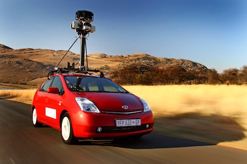
One of the worst kept secrets in SA’s technology industry is finally official. Google will launch an SA version of its popular Street View service. In the coming weeks Google, using Toyota Prius models, will begin driving around the country, taking photographs of locations, including Johannesburg, Cape Town, Pretoria, Port Elizabeth and Durban.
Street View is a popular feature of Google Maps that is already available in more than 100 metropolitan areas around the world. It allows users to explore and navigate virtually a neighbourhood through panoramic street-level images.
The SA Street View images will also be available in Google Earth and on Google Maps for Mobile.
Images collected by the cars will be processed and carefully stitched together, a technological process that can take several months. They will be made available “at a later date” in Street View on Google Maps for SA.
In areas where Street View is available, users will be able to access street-level imagery by zooming into the lowest level on Google Maps, or by dragging the orange “Pegman” icon on the left-hand side of the map onto a blue highlighted street.
Google says the service will be available in time for tourists visiting the country for the 2010 World Cup, which kicks off in June next year. — Staff reporter, TechCentral


