Southern Mapping Geospatial (SMG) is a technology company with a difference. It’s using aerial surveying tech to help predict floods, track pollution, monitor urban sprawl, improve cellular networks, refine farming practices and help municipalities expedite service delivery.
Started a year ago, SMG provides air-to-ground surveying and mapping services. Other than its work for mining, engineering and surveying companies, it is turning its attention to providing data and mapping services to the public sector.
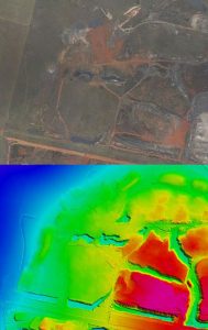
Peter Moir, CEO of Southern Mapping Company (SMC) — from which SMG is a spin-off — says SMC started as a light detection and ranging (Lidar) company. The company uses aircraft for aerial surveying, equipped with a laser pulse device that emits 200 000 pulses every second.
“We can measure latitude, longitude and height above sea level with great accuracy. The data can be used to create very accurate 3D models,” Moir says.
The equipment is linked to a camera and later the company overlays the data models with images. “We can survey cities, mines and even radio propagation — that is, we can identify cellphone reception dead spots and advise companies about where they need more aerials.”
Some of the services SMC has provided include measuring the volume of mine dumps for mining firms and calculating the volume of Eskom’s coal stockpiles. The company also provides satellite imaging services and works with the likes of GeoEye, RapidEye and the Hartebeesthoek Radio Astronomy Observatory (better known as HartRAO).
Though SMC and SMG have many overlaps in terms of the services they provide and the resources they have available, SMC conducts surveys across Africa and the rest of the world, while SMG’s focus is on Southern Africa.
Both companies offer “hyperspectral” imaging services. “Everything on earth has a unique spectral signature,” explains Moir, “so we can set our systems to recognise certain things when we survey the ground, but they have to know what they’re looking for.”

Because hyperspectral imaging measures the entire recognisable spectrum, it is also possible to analyse images and data after the fact.
Moir uses the example of Dutch elm disease: if the company wanted to know how many diseased elms there were in an area that had undergone hyperspectral imaging. It would have to identify the spectral signature of only one diseased elm and could then look for that signature in the rest of the data set.
Hyperspectral imaging technology can pick up other anomalies, such as a leaking slimes dam or minerals in trees and other plant matter that shouldn’t be there. He explains that the system is essentially a “super sensitive camera”.
“Instead of seeing three channels like we do with colour, the camera sees 500 channels. A spectral signal shows each of the channels and everything appears as a unique combination of these channels.”
The technology is also useful in disaster management and early warning systems. One of the proposed applications is a flood warning system on the Jukskei. The company says it could anticipate flash floods and calculate how much the water level is going to rise after rains.
Moir says new uses for the technology are constantly emerging. Comparing historical data is useful. “There’s a lot to be gleaned from looking at previous images and current ones and, as we record greater numbers of spectral signatures, the scope of what we can extract from our data is increasing, too.”
Hyperspectral imaging forms part of what has become SMG’s core business of geographical information systems (GIS).
Dumi Sibandze, SMG’s CEO and a former commercial pilot, says the company is involved in supporting SA’s bid for the Square Kilometre Array (SKA) radio astronomy telescope. “We’re providing the GIS information and measuring solar radiation for the proposed main site in SA as well as for the spiral arms across Africa.”
Sibandze says GIS is also being used to gather spatial information to assist municipalities. When combined with existing data sets and archival images of various areas, SMG is able to provide useful images of these areas. “We’ve got a great picture of present-day Polokwane that shows how RDP housing is growing and the informal settlement is shrinking.”
He says the applications for Lidar and hyperspectral imaging are growing quickly and SMG is trying to show municipalities how useful it can be in measuring their successes and recognising where service delivery needs improvement.
SMG has found use of GIS in smaller municipalities has been eroded. “The municipalities don’t understand why they’re battling with service delivery because they don’t have this data.” — Craig Wilson, TechCentral
- Subscribe to our free daily newsletter
- Follow us on Twitter or on Facebook

