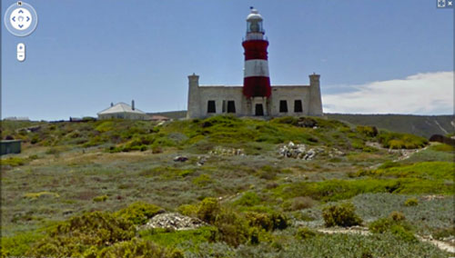
Google has expanded Street View, its street-level imaging software in Google Maps, and is now offering more images of areas in Limpopo, the Western Cape, the Northern Cape, Free State, North West and Mpumalanga.
In a posting on Google Africa’s blog, the company says the new Street View images now include Cape Agulhas, the most southerly tip of the African continent where the Indian and Atlantic Oceans meet.
“Coastal fans can take a drive through the beautiful West Coast National Park, check out imagery of Saldanha Bay, an important natural harbour and port town, or visit Port Edward,” Google says in its blog post.
Other places added to the SA Street View images include Polokwane, Mokopane, Mthatha and Harrismith.
The updated imagery includes higher resolution panoramic views of places throughout the San Francisco Bay Area, Los Angeles and San Diego.
Google first launched Street View in the US in 2007. It is now available in 27 countries. New imagery is available in 13 countries, namely SA, Denmark, Ireland, Italy, Spain, The Netherlands, Norway, Sweden, Romania, Taiwan, Japan, the US and the UK. — Staff reporter, TechCentral
- Subscribe to our free daily newsletter
- Follow us on Twitter or on Facebook


