[dropcap]C[/dropcap]apetonians, and South Africans more broadly, are turning to interactive online maps to see the destructive power of the storm that’s moving into the western parts of the country on Wednesday.
The Earth website, which describes itself as a global map of wind, weather and ocean conditions, provided a great view on Wednesday morning of the gale force winds lashing the Western Cape, bringing torrential rain to the drought-stricken province (see image above, or click through to the live chart).
Reports began emerging on Wednesday morning of trees being uprooted, widespread power outages and roads being flooded across Cape Town — and, according to weather forecasters, the city is only expected to bear the full brunt of the storm later in the day.
Wind gusts
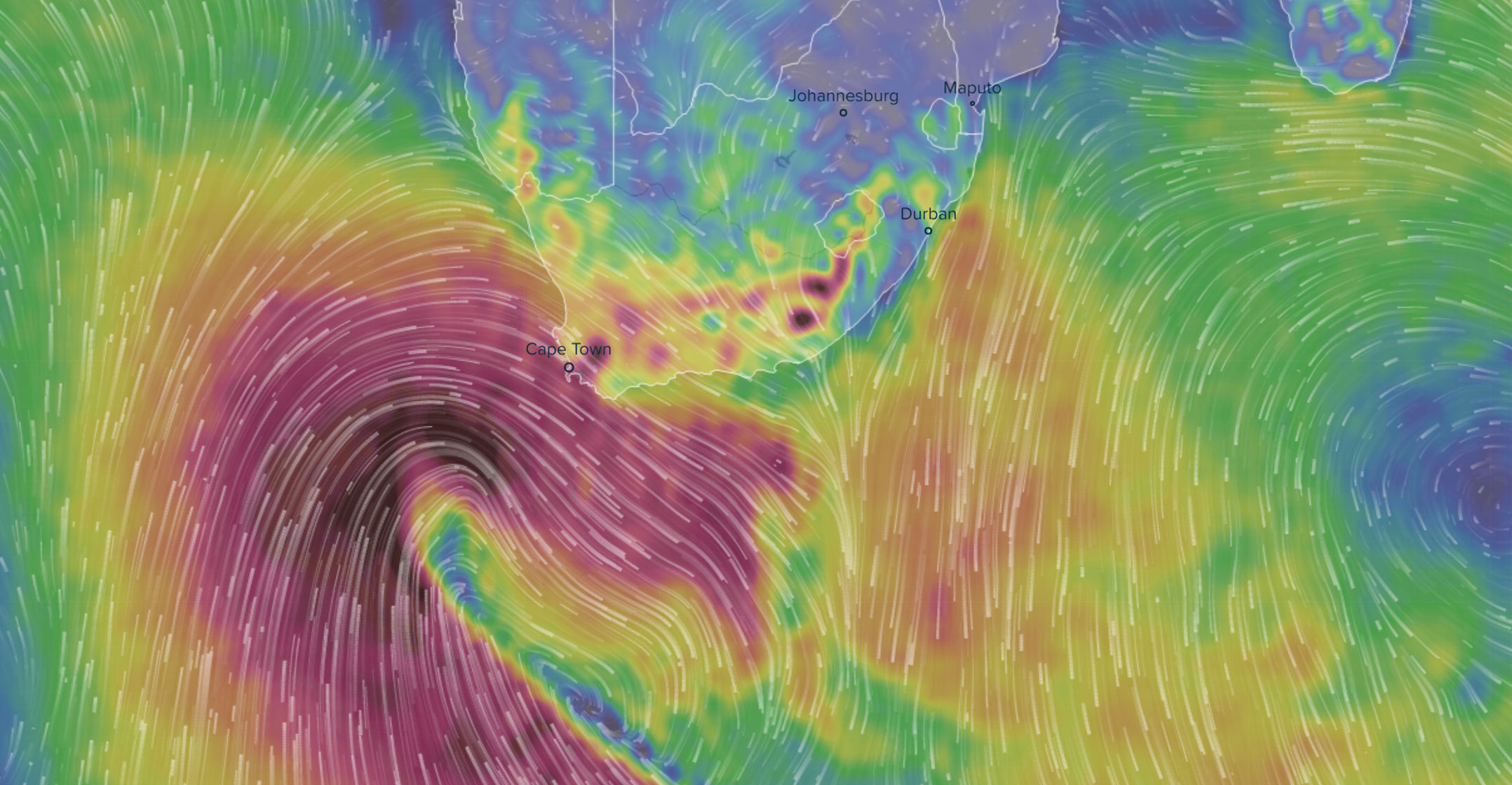
The Ventusky website, which provides a wide range of interactive meteorological data — including wind speeds, wind gusts, air pressure, clouds, rain, temperature and wave height — showed the core of the storm still lying to the west and southwest of Cape Town at 8am on Wednesday.
The chart below from Ventusky shows wind gusts on Wednesday morning of more than 150km/h around the storm’s core. The system is moving slowly to the east.
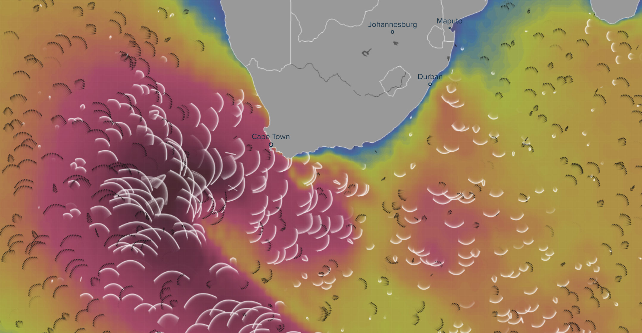
The low-pressure system is causing rough sea conditions in the oceans south and west of the city on Wednesday, with Ventusky showing wave heights in excess of 12m over a large area. By contrast, waves are lower than 2m ahead of the storm, along South Africa’s eastern shoreline:
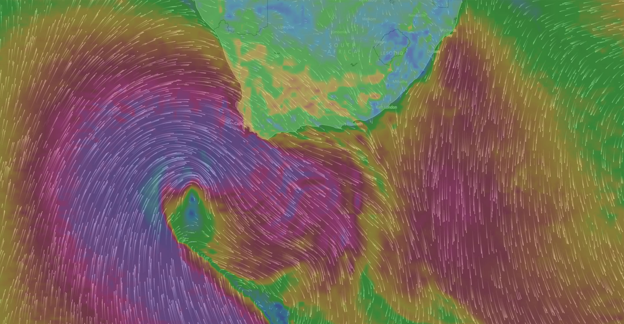
Website Windy.com, meanwhile, is also showing off the amazing power of the winds being carried by the system:
The chart below, from the South African Weather Service, shows the position of the low-pressure system and associated cold front as of midnight on Wednesday morning.
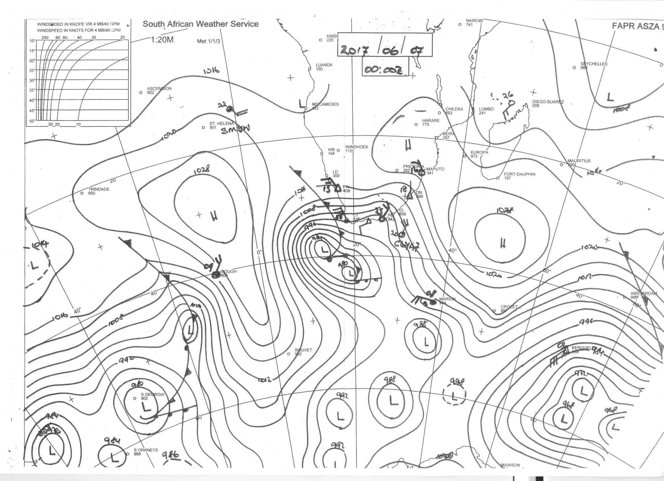
In a statement, the Weather Service warned that gale to strong gale force winds are expected over the Western Cape, western parts of the Northern Cape interior as well as along the coast from Tuesday night, persisting until Thursday, when it will start moderating from the west.
Heavy rain and flash flooding are expected in places over the western parts of the Western Cape, areas such as the Cape Metropole, Cape Winelands and Overberg on Wednesday into Thursday morning, it said.
“Very high and rough sea conditions with possible storm surges are also very likely along the entire coast of the Northern and Western Cape, which will experience the brunt of the damaging waves.”
High sea conditions, with wave heights of between 6m and 8m will occur from Wednesday morning between Lambert’s Bay and Cape Agulhas.
“By Wednesday afternoon, sea conditions are expected to reach very high seas, with wave heights of between 9m and 12m stretching between Cape Columbine and Cape Agulhas, and then extending north towards Alexander Bay by Wednesday evening as well as into Plettenberg Bay.” — © 2017 NewsCentral Media


