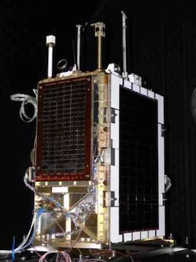
 The launch of SA’s first government-owned satellite from the central Asian republic of Kazakhstan aboard a Russian rocket has been postponed to Wednesday, the ministry of science & technology said.
Spokesman Lunga Ngqengelele said in a statement that SA had been informed that the launch of the SumbandilaSat, the country’s low-earth orbiting satellite, had been postponed by 24 hours.
The launch was expected to take place in Kazakhstan on Tuesday evening, and would now occur on Wednesday at 5.55pm due to a technical error.
Ngqengelele said technicians were working on the problem. The R26m SumbandilaSat is expected to be piggybacking on a Russian Soyuz rocket, which will blast off at 5.55pm local time from the Baikonur cosmodrome in Kazakhstan to launch a Russian weather satellite called Meteor.
The 81kg satellite, which will orbit 500km above the equator and pass over SA four times a day. It will collect images for use by government in agriculture, water management, urban planning and other domains.
Commissioned by the department of science & technology from a company in the Western Cape, the Sumbandila, which means “to lead the way” in Venda, was originally supposed to be launched in 2006 from a Russian rocket over the Barents Sea. However, “geopolitical issues” torpedoed that launch, according to Khalid Manjoo, team leader for assembly, integration and testing at SunSpace & Information Systems, the company that built the satellite.
The US was concerned about a Russian rocket being launched into orbit over its territory and Russia had to cancel the launch.
The project lay dormant until mid-2008 when SA and Russia signed a new agreement on space co-operation, which sees Russia launch the satellite pro bono. Russia is also co-operating with SA on the establishment of SA’s own space agency, which is expected to be launched by the end of the year.
This is the first government satellite from Southern Africa. Elsewhere in Africa, Egypt and Nigeria have also launched satellites.
SA’s first satellite, SunSat was launched in 1999 as an experiment by the University of Stellenbosch and exhausted its lifetime in space two years later.
SunSpace & Information Systems, the Stellenbosch-based company that developed the government satellite, was formed out of the SunSat project.
Though SumbandilaSat will serve SA first and foremost, it can also be used to view “any part of Southern Africa or the world,” Manjoo told the German Press Agency DPA earlier on Tuesday.
SA’s ultimate aim was the creation of a constellation of satellites for disaster management in Africa, according to Manjoo. “This would be a technology demonstrator,” he said.
The satellite’s main imager, which has multispectral imaging (views light in different spectral bands) has a ground resolution of 6,25m, meaning it can identify any object that is 6,25m long. — Sapa


