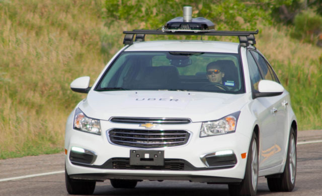
Internet ride-hailing service Uber has begun mapping Johannesburg, using specially equipped vehicles to gather imagery and other information aimed at improving its core product.
In 2016, Uber started putting mapping cars on the road in Mexico, Canada and the UK to acquire data to help with trip accuracy. In January, mapping cars hit the road to help continue its mapping efforts in Johannesburg, it said on Tuesday.
Uber kick-started its South African mapping efforts in Cape Town in November last year, with partner cars equipped with mapping equipment and driven during trips on the Uber platform for two weeks.
“Mapping in Johannesburg will assist in getting the relevant information to help Uber work at its best, such as traffic patterns and more precise pick-up and drop-off locations,” the company said. “The mapping will also provide additional details where there aren’t detailed maps — or street signs.”
It said mapping is core to its app. “Without maps, Uber would simply not be able to provide reliable trips to its riders. Behind the rider’s app is a host of technology at play, like mobile mapping and GPS, that help riders get to the right destination in the estimated time provided.”
By partnering with driver-partners, Uber is able to map cities without putting additional vehicles on the road, it said.
“Information captured will track the best routes for riders and drivers as well as identify street segments that are better suited for pick-ups and drop-offs without revealing any rider private information and identity,” the company added.
Uber has only partnered with drivers who are prepared to accept the mapping device being attached to their vehicles. Riders will have the option of cancelling the trip should they not be willing to participate. They will also be informed in the app or via text message that their ride has the mapping device fitted to it.
The devices do not retain any imagery at or around initial pick-up or final drop-off locations, Uber said. — (c) 2017 NewsCentral Media


