 South African climate experts have warned of the pending El Niño system building in the Pacific Ocean, which could bring severe drought to the region. But what is this event that brings extreme weather to different parts of the world?
The El Niño-Southern Oscillation (Enso) is one of the most important climate phenomena on Earth due to its ability to influence global atmospheric circulation.
El Niño and La Niña are, respectively, the warm and cool phases of a recurring climate pattern across the tropical Pacific; by regularly monitoring Enso, researchers have evidence that a moderate-to-strong El Niño is developing in 2023.
At a recent El Niño 2023 Summit held at the University of Pretoria, CSIR senior researcher and Alliance for Collaboration on Climate and Earth Systems science director Neville Sweijd emphasised the need for early preparation for the potential impact of the El Niño in South Africa.
“What is different and concerning this year is that published data shows that global average sea surface temperatures reached unprecedented levels in May and June 2023 and, already, records for June air temperatures are being broken in the northern hemisphere. This means that the El Niño is likely to be unusually strong,” he said.
“Although we are certain that an El Niño is manifesting, we are uncertain about what impact it will have at this stage. In the past, the impact was severe and, although we cannot say yet that this season will be equally affected, we must pre-empt the potential impact. It is quite unpredictable by nature, but there is a general pattern that researchers in South Africa have been studying,” Sweijd said.
More frequent El Niños?
“While the changes in weather and climate are continuous, the concern is whether, in the long term under the influence of global warming, this type of event will occur more frequently, as climate models suggest.
“The El Niño is still to peak and its impact on the southern hemisphere summer is yet to be assessed. The models we use have not produced typical forecasts for an El Niño, with some parts of South Africa being uncertain while others are drier that normal (typical of El Niño). Still, signs are trending to a drier season overall – but we cannot be sure at this stage,” he said. “The models are predicting a warmer than normal season in terms of maximum temperatures.”
Get TechCentral’s daily newsletter – it’s free
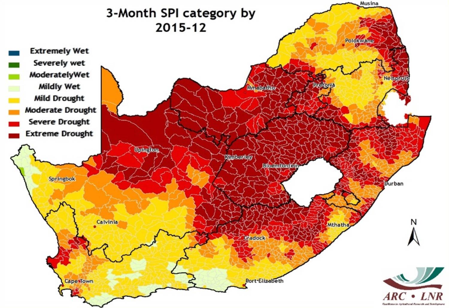
University of Pretoria professor of meteorology Willem Landman said that while there is a well-understood relationship between Enso and extreme weather in South Africa, the extent of the impact can vary greatly. However, most previous droughts in the summer rainfall regions of the country, and seasons with a high frequency of heatwaves, have historically been associated with El Niño events.
The South African Weather Service showed how previous Enso events affected the seasonal rainfall and temperature in the country and demonstrated the impact of the 2015/2016 El Niño event on agricultural production, human health and food security.

But the experts did note that one ameliorating factor is that the region has experienced good rains over the last few years and this might dampen the impact of a potential drought.
Weather Service forecaster Dipuo Thwana had some good news. She said that although El Niño is associated with drier conditions and above normal temperatures, spring – in South Africa deemed to be September, October and November – evidence points to a dominating system that could produce above-normal rainfall.
The western bushveld in Limpopo will experience lower than normal rainfall, as will parts of the Free State and North West. But Gauteng, KwaZulu-Natal and Mpumalanga will have higher than normal rainfall in those months, forecasting models predict. What is less clear is how the country will fare from January, especially if El Niño intensifies into a powerful event, as some forecasters believe it will. – © 2023 NewsCentral Media


