Finnish handset manufacturer Nokia is adding a check-in service, additional traffic and public transportation information and a route-recording facility to its location services. It is also integrating an augmented reality application into its new range of handsets.
The company says it now has mapping data in 196 countries and is updating this data all the time because of the speed with which it changes, particularly in emerging markets.
Thom Brenner, Nokia’s vice-president for applications, locations and commerce, says “location is always important because we are all always in one”. He says Nokia thinks information about traffic and public transport should be available at a glance and that people should be able to find information about their own neighbourhoods, “like that new hot cafe that you haven’t discovered yet”.
“We’re trying to help you capture your footprint on the Earth, and make it easier to tell people where you are, or that you arrived safely, or that you’re somewhere and would like to meet them.”
Mark Thomas, director of consumer product marketing, location and commerce at Nokia, says that typically people use navigation devices when they’re lost, not when we know where they’re going.

He says the new Nokia journey planner incorporates Nokia Maps traffic information and includes a “commuter assistance mode” that learns people’s routes, offers alternatives and considers traffic information so they can choose the best route every time, even for routes they use often.
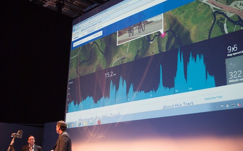
Thomas says Nokia is also introducing Tracks, an app that can create tracks for runners and cyclists, for example, as well as geotag photos taken during a journey, recording the path taken and inserting images in it, which can then be viewed as a timeline.
In addition, Nokia is including its own check-in service on new handsets that it calls Pulse. This allows users to share their location with a selected friends and can be used in combination with Nokia’s mapping services to provide directions.
Nokia Maps is also set to include augmented reality overlays using the built-in camera in the company’s handsets. The app, called LiveView, allows users to point the camera down a street, for example, and have the phone provide items of interest such as restaurants and hotels and have this overlaid on the image being produced by the camera. Users can even get read reviews and get other information of the places that come up on the overlay.
For cities with large public transport systems, Nokia has built a journey planner that receives live data from transport operators to calculate optimal routes and anticipated journey times.
Meanwhile, Nokia Maps 3D has had its functionality expanded to include summaries of city information, curated lists of restaurants, accommodation and attractions, and reviews from sites like TripAdvisor and individual users. The service is aimed at travellers and those looking to find out more about the area around them.
Perhaps the best feature of the updated mapping functionality is that users can download maps of areas for offline use, for planning trips, or when they plan to travel in an area in which they might not have connectivity. — Craig Wilson, TechCentral
- Subscribe to our free daily newsletter
- Follow us on Twitter or on Facebook
- Visit our sister website, SportsCentral (still in beta)


