Most people use mapping software every day without giving it a second thought.
Whether it’s using Waze or Google Maps on a smartphone or pinning a location on a website to check Internet coverage, maps are indispensable in modern life.
But most maps are proprietary in nature. Though often free, they place restrictions on what people can do with them, serving to crimp innovation in mapping.
OpenStreetMap, or OSM, hopes to change that, by building “a collaborative mapping project to build a map of the world”. And a South African, Grant Slater, now living in London, is intimately involved in OSM as its senior site reliability engineer.
OSM is widely used, including by major corporations such as Apple, Facebook, Microsoft, Air France, Uber and Pinterest.
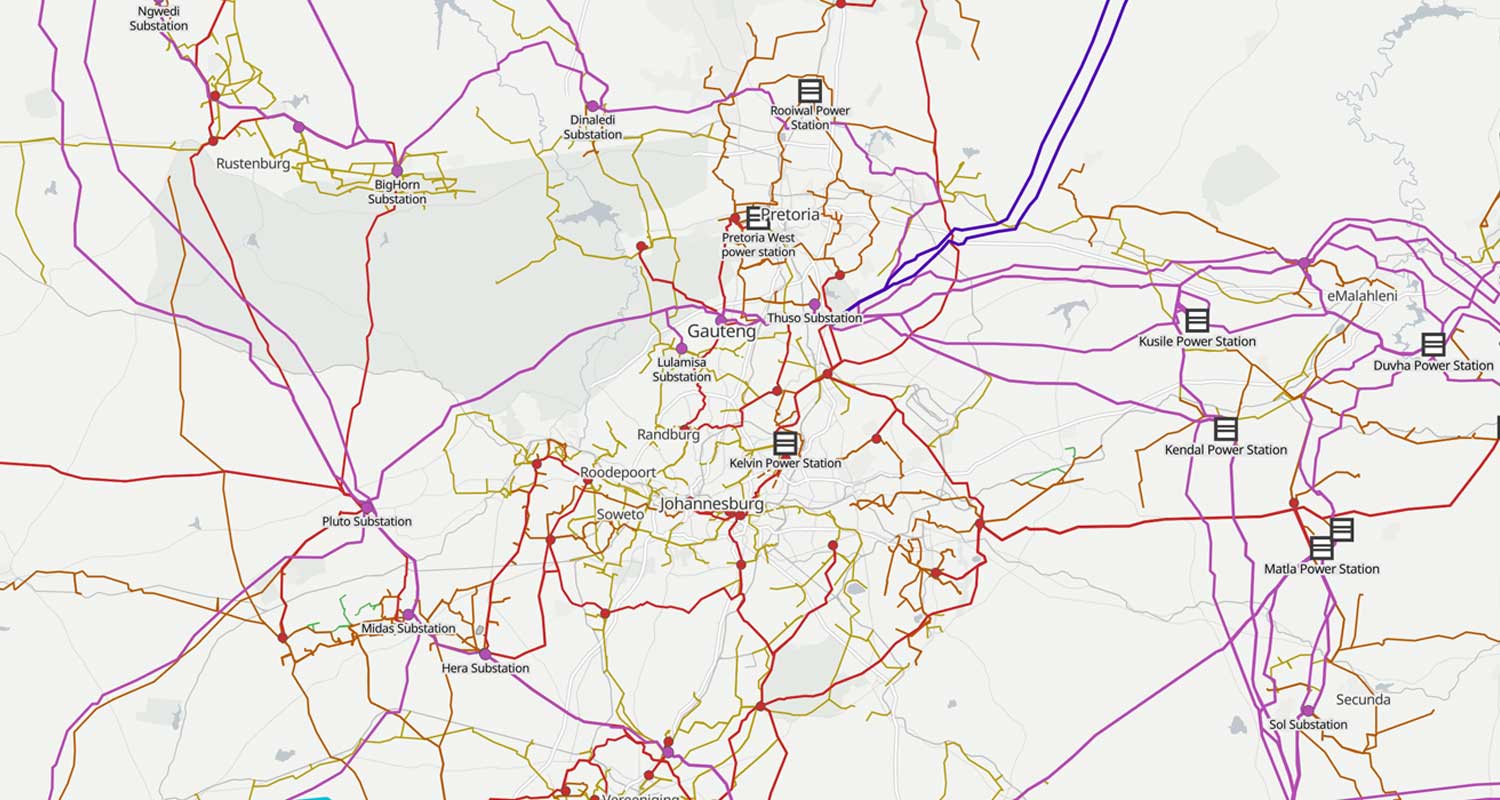
Slater explained in a virtual interview with TechCentral how maps have been created of just about everything that can be mapped. Even Eskom’s national electricity grid and those of other utilities around the world have been mapped in incredible detail. More than two million people worldwide contribute to OSM, though there are “never more than four or five people working on the OSM infrastructure”.
What follows is an edited interview with Slater about OSM, its uses and its potential – and the Open Infrastructure Map that has mapped out power grids around the world, including Eskom’s.
How did you start at OSM?
I thought of mapping in the early days of OpenStreetMap, and the first thing I mapped in South Africa was a train line during a visit to South Africa about 15 years ago. I was on a train from Port Elizabeth (now Gqeberha) to Johannesburg. I had a very early GPS device. I recorded the train tracks and then added them to OpenStreetMap. (Slater admitted he has a big interest in trains, and even has a collection of South African railway timetables dating back to the 1920s.)
How and why did OSM get its start?
It was started by Stephen Coast in London in 2004. He had just been given a GPS for Christmas and wanted to build a map. He was looking at how to get the map data to build it. It wasn’t available for free – in fact, the map data was insanely expensive. He realised he could use his new GPS to walk around his suburb and build a map. It quickly turned into a project, and people started to contribute. The project grew rapidly using crowdsourced map data. (Coast has since moved on from the project.)

We were interested to see South Africa’s electricity transmission infrastructure mapped in great deal on OSM. Was that all crowdsourced?
A bunch of people were involved. I posted on a Slack channel called ZA Tech about it, with a link to the map. I’ve done about 10-20% of the mapping of the Southern African power grid, but there are a few people behind the work. There’s a guy in Germany, or I assume he’s in Germany, who is very active. He understands the more technical aspects of the power grids and how many cables, voltages and step downs there are at the various substations.
Where does the data for the power grid come from?
Well, sometimes the data comes from when a substation blows up and there’s a news article about it. If it mentions the name of the substation, we put it on the map. There are also a few people who work in the industry who give us data every now and again, and we get data from Eskom’s annual report.
How can people help with the Open Infrastructure Map project?
Anyone can add data to it. We encourage people to add detail; if it exists on the ground, we want to know about it. Whatever people’s interests, there’s probably a map for it.
There are some good mobile apps that really help in adding detail to the maps. One is Street Complete, which is like a game that asks you questions, and you have different challenges to complete. Then there’s Every Door, which is more about focusing on points of interest – is there a Spur on your street corner and is it disabled friendly?
Are you able to source mapping data from local authorities?
The City of Cape Town provided up to date, 6cm aerial imagery – very much higher than people are used to seeing in maps. The City of Johannesburg weren’t as helpful. I begged them for years to release aerial imagery to the project, but they were commercially minded and wanted an insane amount of money. (OSM was later able to get the same imagery from another source, Esri.)

How many people contribute to OSM?
Contributors are called Mappers. There are between 20 and 200 South Africans contributing on any given day. It’s a broad set of people, many of whom have a mapping background. They work in GIS (geographic information systems). We also have people contributing to the humanitarian response, particularly in Durban (the site of catastrophic floods in 2022). Many humanitarian agencies use OSM when responding to disasters.
OpenStreetMap data is widely used now. If you use Apple Maps, the data for South Africa comes from OSM, and Apple contributed a lot of data two years ago, including high-resolution aerial imagery. Apple traced all the roads, including farm roads, and new developments that weren’t previously incorporated.
South African National Parks also contributed data for Table Mountain, and hikers from the University of Cape Town have added more detail. Ride-hailing company Bolt has also contributed data.
How do people contribute?
The most important thing is to get an OpenStreetMap account. Then use one of those apps that I mentioned (Every Door and StreetComplete). I suggest signing up to openstreetmap.org and then trying Every Door, which is available on Android and iPhone., or StreetComplete, which is only available for Android. – © 2023 NewsCentral Media

